Mires
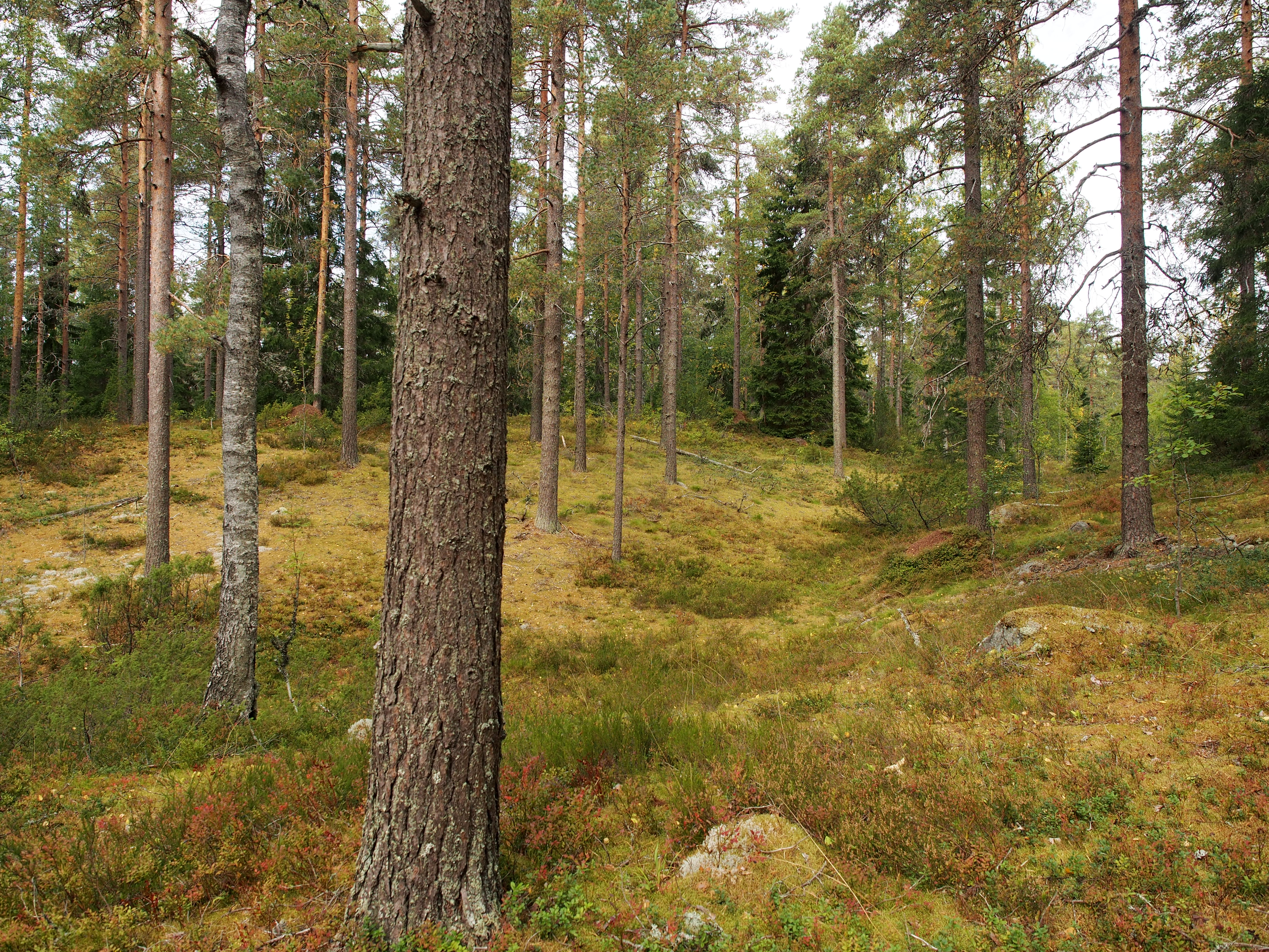
Mires account for one third of the Geopark’s surface area. The climate of the area has both southern and northern features, which is also visible in the mire nature of the Geopark. With the exception of the Palsa mires in Fell Lapland, nearly all the combined mire types found in Finland are present in the southern part of Suomenselkä, in the area between natural and cultural Finland. The raised bogs in the area are particularly typical. The name for raised bogs originates from the Geopark area, where the exceptionally well-preserved mire evolution can be observed in everything from young coastal mires to old inland mires.
Why are the mires well preserved in the border areas of Northern Satakunta, South Ostrobothnia and Pirkanmaa? This is due to the geographical conditions and geology of the region. The relatively high but gentle sloping watershed area of Suomenselkä passes through the Geopark area towards the seashore. Due to the lack of agricultural land, the region is a sparsely populated realm of forests and mires. Only some of the mires in the area have been cleared and turned into fields.
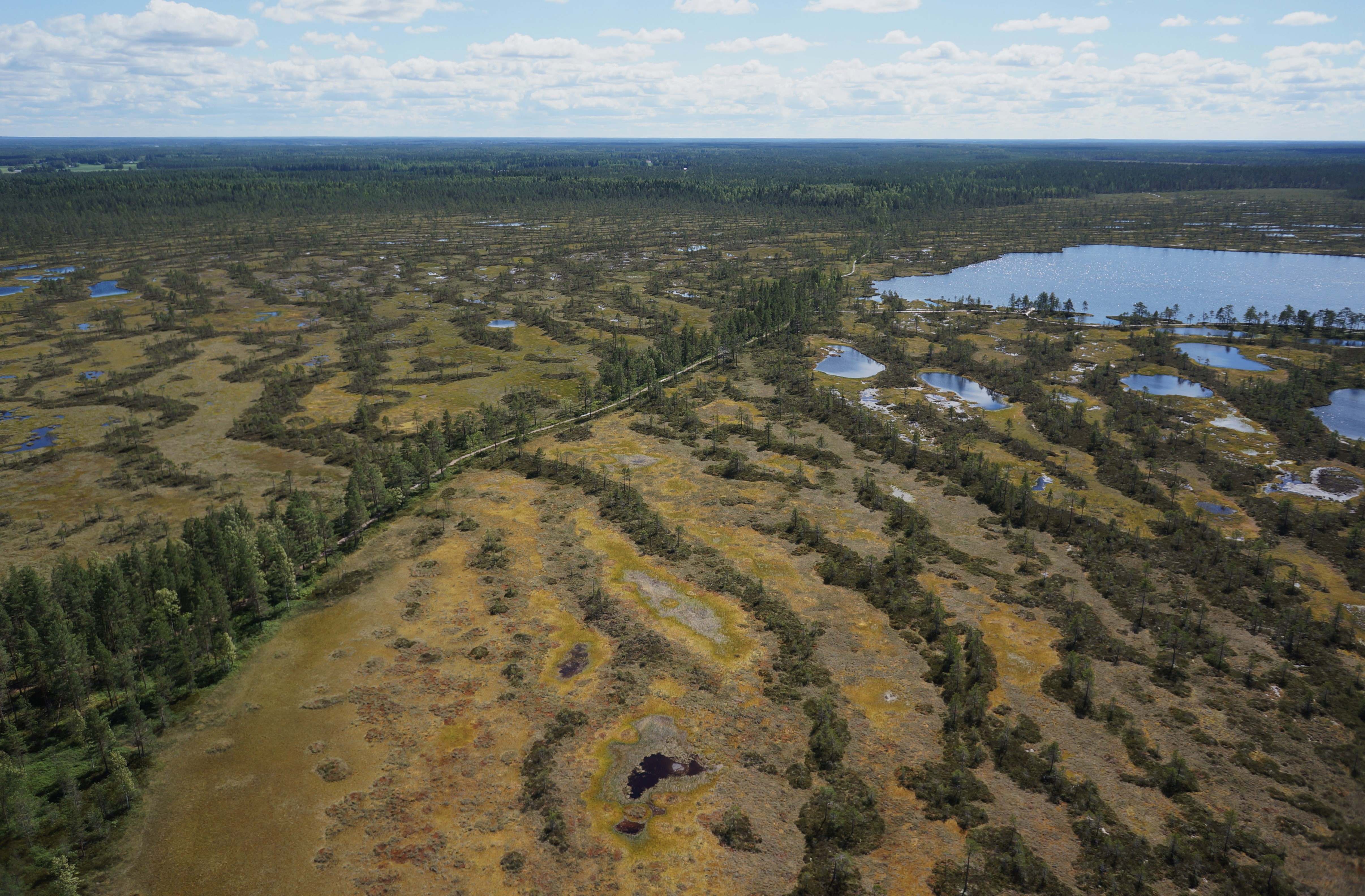
Aerial photograph of Kauhaneva: the structure formed by the hummocks and morasses of the mire surface can be best seen from the air.
The Geopark area is one of the fastest rising areas along the Finnish coast, and the ground surface in the area has risen up to 200 metres above sea level in the last 10,000 years. Because the high-elevation land captures moisture from the Bothnian Sea as rain, its gently sloping terrain is susceptible to the formation of mires. Soil in the Geopark area also has post-Ice Age features that promote the accumulation of water in depressions.
Mires are not just peat deposits. They are living and constantly changing communities of organisms that form themselves. In mires, biology generates geology, the decomposition of mire vegetation remnants is prevented, thus producing an organic soil, peat. Water and suitable climatic conditions are needed for mires to develop. In the middle-boreal life zone, to which the area belongs, the conditions for decomposition are ideal. More rain falls in the area than can evaporate or run out of the area.
Facts about Geopark mires
Union of mires, soil and groundwater
The mires are not separate from their surroundings, but live and evolve in constant interaction with their environs. In addition to the rain, mires benefit from groundwater accumulated from the mineral soils surrounding them. Along the shoulders of ridges, groundwater is discharged from springs into mires, thus enriching mire nature in a variety of ways. Water also runs in the other direction: in the spring, mire and meltwater accumulate on the edges of mires, turning them into extensive seasonal wetlands, from which water is absorbed into the soil as summer progresses, thus forming groundwater.
Large amounts of water are stored in mires. The water content of peat is approximately 70–80%, which means that there is almost as much water in a mire hundreds of hectares in size as an equivalently sized lake. However, only a small part of the water contained in a mire flows. In raised bogs, the water flow is limited to the surface of the mire. The water, ice and frost flowing there produce surface shapes that face against the direction of the water flow. This forms hummocks, dry ridges crossing the mire, and wet morasses. The surface structure reveals the water courses in the mire. In raised bogs, water usually flows from the middle of the mire out towards the edge. The wettest parts of a raised bog are often at the edge of the mire.
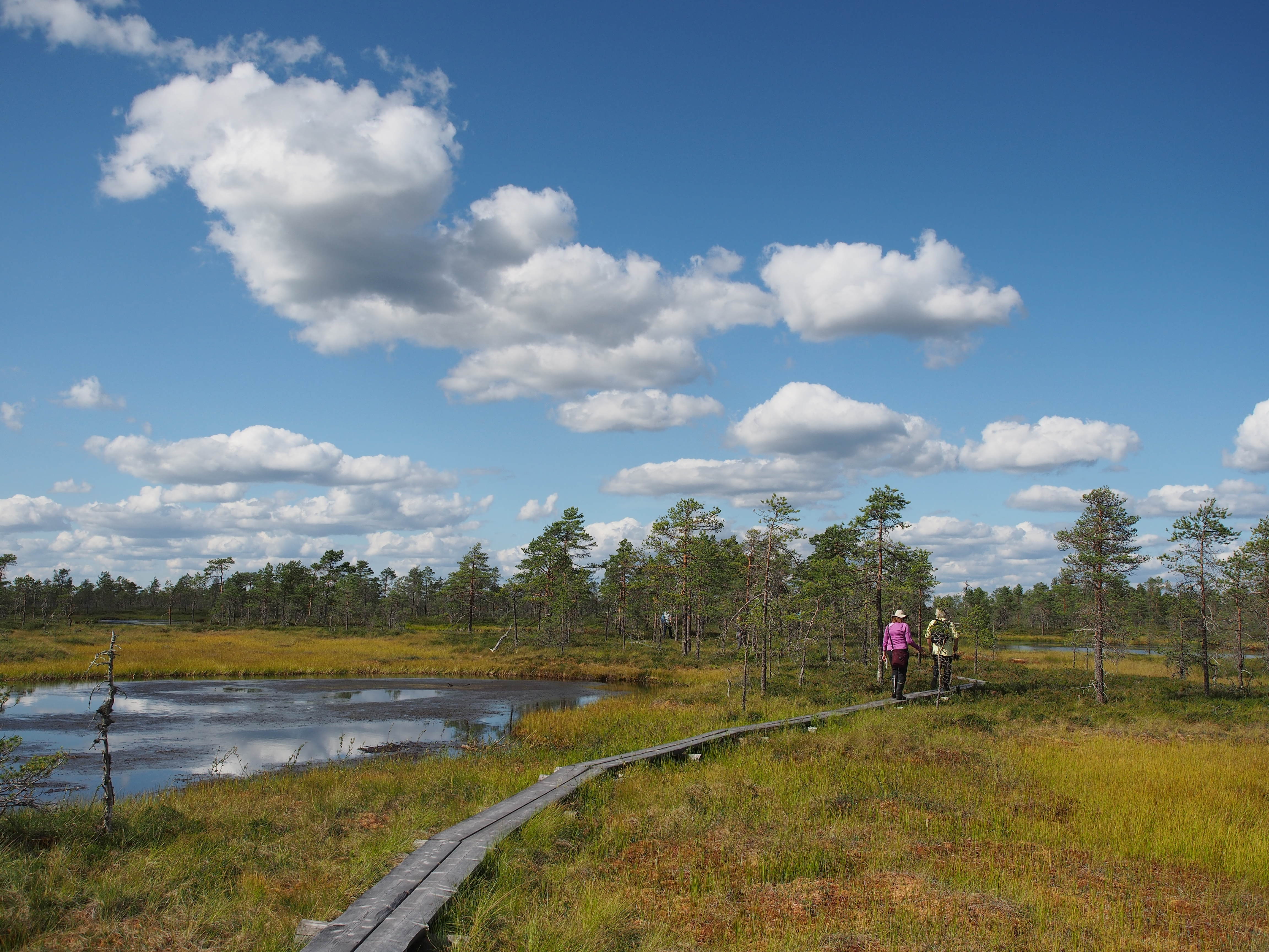
The finest raised bogs in the area are Kauhaneva and Huidankeidas. An easily accessible aapa mire is located near Käskyvuori hil at Käskylamminneva. Alkkianvuori hill at Raatosulkonneva, on the other hand, has the features of a slope mire, which are typical for Koillismaa. The best examples of groundwater mires can be found in Peräkorpi, Lauhanvuori, where there are also several seasonal wetlands.
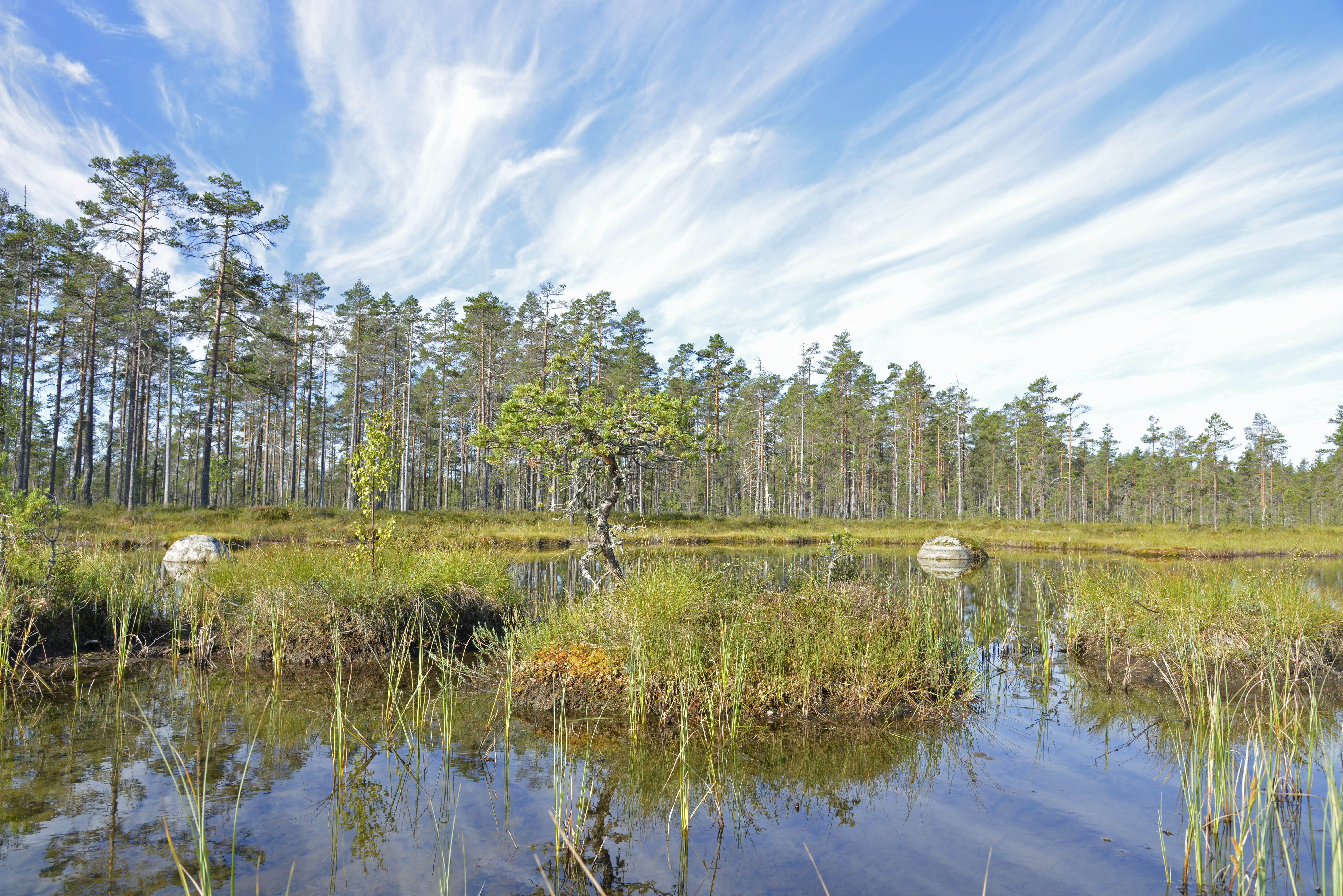
Seasonal wetland in Peräkorpi, Lauhanvuori.
Mires are a natural archive
In the mire, peat is formed when mire vegetation dies. Their remnants are buried under more recent vegetation layers in low-oxygen conditions, slowly turning into an incompletely decomposed plant-based pulp, i.e. peat. The sphagnum moss typically found in raised bogs forms a particularly large amount of peat – its top sections grow continuously higher, while its bottom section decomposes.
In addition to water and nutrients, all kinds of small dust, plant seeds, soot, atmospheric contaminants and pollutants fall from the sky into the vegetation layers of the mire. As the peat layers grow, these are buried inside the mire. By drilling into the mire with an auger, a cross-section of the mire layers can be obtained from which, for example, the vegetation conditions of the past can be studied by analysing pollen ratios. The spread of human settlements to areas dominated by mires is reflected in the increase in soot content and crop pollens found in peat layers. Ash layers caused by ancient volcanic eruptions can also be found in peat layers. For example, the Hekla volcano in Iceland has erupted several times in the last thousand years.
Peat layers contain carbon. As plants grow, they bind carbon. By studying the isotopic ratios of carbon, it is possible to calculate when a plant died. This dating method, known as the radiocarbon dating, tells the exact age of mire deposits. This makes it possible to determine the history of mire development and place other observations made on a given timeline.
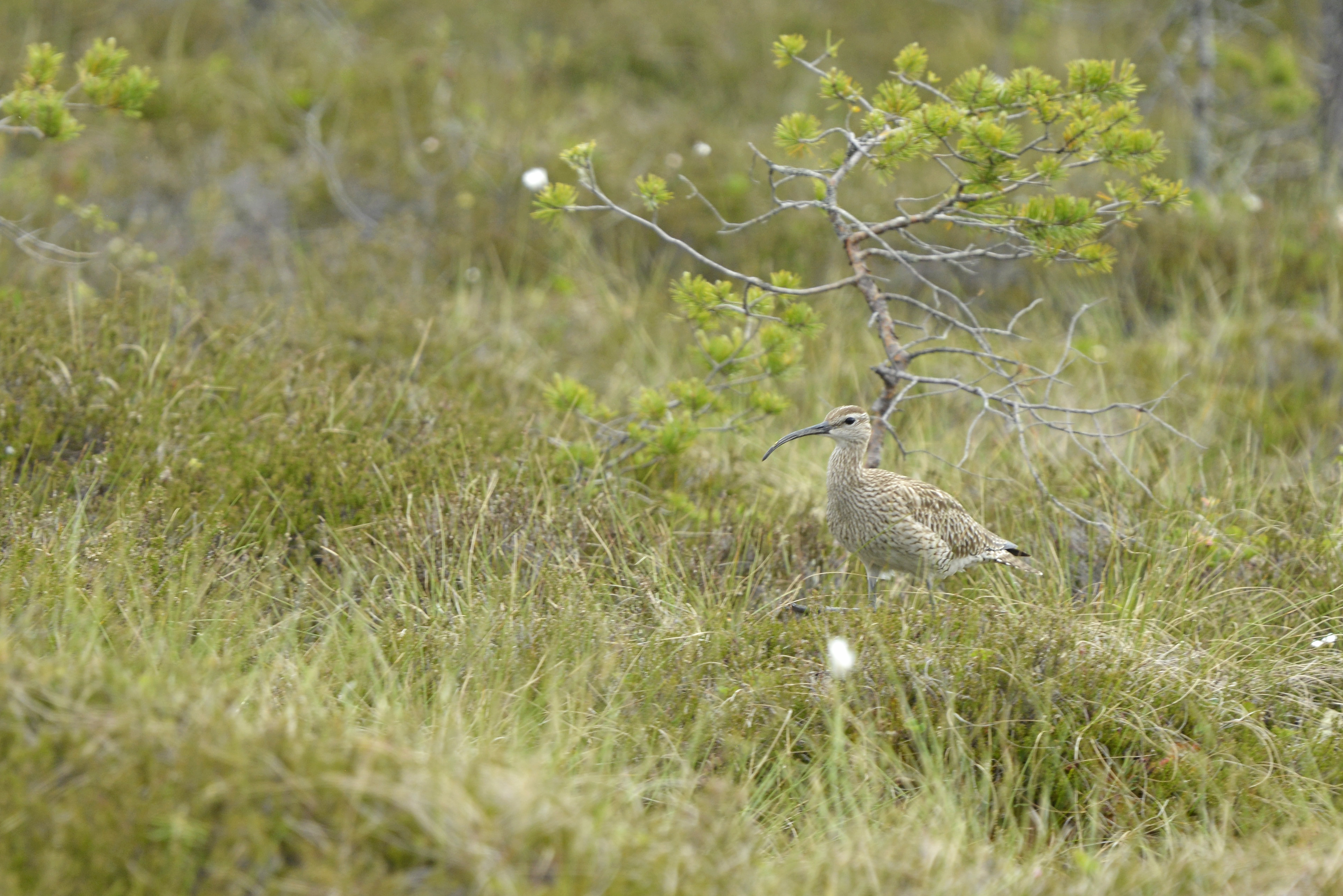
Eurasian whimbrel at Kauhaneva.
Ice Age behind mires
In addition to climate conditions, the development of mires in Finland has been accelerated by the land uplift after the last Ice Age. Due to the slow rebound of the earth’s crust, which had been pressed down by a nearly three kilometre-thick continental ice sheet, the ground surface is still rising to this day by approximately one metre per hundred years, especially on the western coast of Finland. This explains why the sea bays are becoming gradually shallower. In many cases, mires are formed in these areas immediately when the land rises above sea level. Many of the mires in the Geopark area were originally formed from sea bays or when water basins cut off from the sea became overgrown.
Soil types that retain water well are some of the remnants of the Ice Age in the Geopark area. Particularly in the northern section of the area, there is dense boulder clay, which was formed at the end of the last Ice Age. The layer known as hill clay also covers layers that pre-date the last Ice Age in places, which is why mires and lakes are also found on top of eskers that were formed before the last Ice Age.
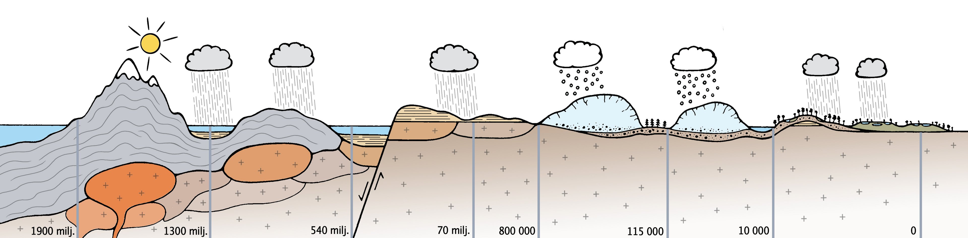
Simplified diagram of the geological development phases of the Geopark area. The time shown in the image is not linear, as there are long periods of time in the development history of the area without any traces of events.
Ice Age facts
Gentle Ice Age
The Ice Age in the Geopark area was exceptional. Most of the area was located between the ice lobes of the continental glaciers for several glaciation periods. This is why there was less wear caused by the ice sheet than average. Several of the most recent layers formed during the Saale glaciation that are older than the Weichsel glaciation are known to be in the Lauhanvuori area. There are also traces of formations (e.g. mires, soils or river channels) that occurred during warm periods (interglacials) between the glaciations. During the ice-free phases of the Ice Age, structures typical of permafrost emerged in the soil of the area.
Not all the factors behind the mildness of the glaciation period are known. However, the topography of the area and the high permeability of soil layers pre-dating the Ice Age may have contributed to this. The Geopark area has plenty of weathered bedrock formations, clay-like and gravel-like soil layers that decomposed in place during ancient periods of climate warming. The highly water-permeable layers may have served as drainage channels, which prevented the formation of a subglacial lake, which is vital to the flow of the continental ice sheet. Continental ice sheets, especially in the middle of the Geopark area, have often been cold-bottomed, which is why they caused little wear.
Channel formed by meltwater in the moraine soil at the top of Lauhanvuori hill.
Landforms resulting from weathering
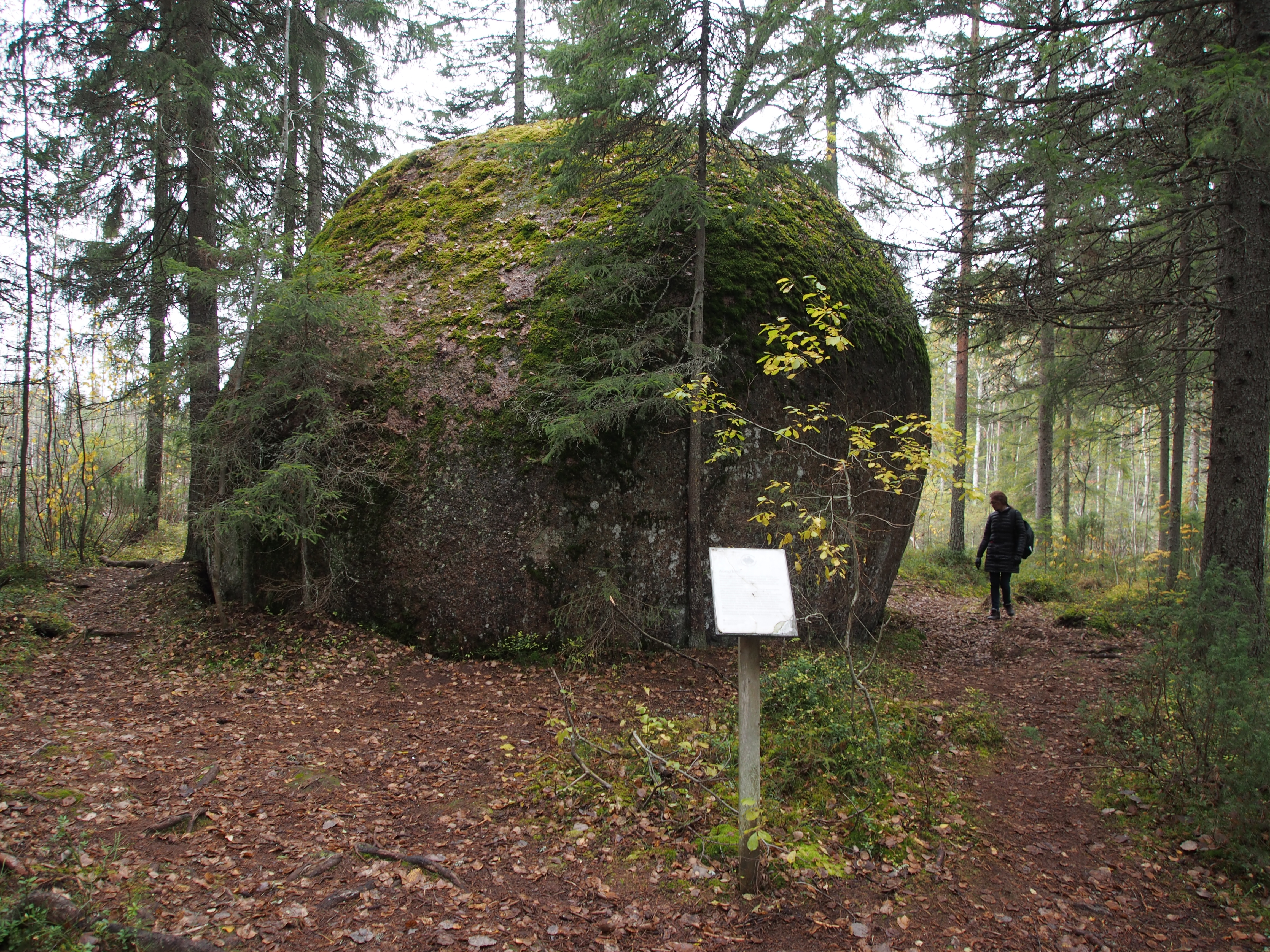
Although rock is hard and durable, exposure to heat and humidity is enough to make it crumble. This weathering first turns the rock into gravel, then sand and finally clay. These weathered bedrock formations are found in the environs of Lauhanvuori and in Nummikangas. Weathered bedrock was formed in warm climate conditions millions of years ago. In addition to the conditions, their formation was influenced by the type of bedrock. In particular, coarse granites typical of the area are sensitive to weathering under suitable conditions.
The weathering of granite is promoted by its susceptibility to fissuring. However, the intensity of fissures in granite varies, and rock with very low fissuring intensity is more resistant to weathering. Areas of low fissuring intensity in weathered bedrock areas can usually be distinguished by intact pinnacles, which rise higher than their surroundings. Dozens of these weathered remnants, known as tors, are found in the area around Lauhanvuori. The best known tor is Aumakivi Rock.
The preservation of weathered bedrock in the area is extraordinary, as the area was covered by continental ice sheets on several occasions. One factor protecting against weathering may have been the sedimentary rock that used to cover the area.
Aumakivi Rock, the largest and most famous tor formation in the area.
Remnants of sedimentary rock
Lauhanvuori sandstone is Finland’s largest deposit of Cambrian sandstone found on dry land. It covers an area of approximately 60 km2. Sandstone, which consists primarily of densely cemented quartz, is a sedimentary rock. Based on the structures found there, the sand contained in the rock was initially deposited in the coastal zone of an ancient sea, probably in an estuary. The sand, which is mainly composed of quartz, probably originated from the last, highly eroded vestiges of the ancient Svecofennides mountain range.
The landscape of the ancient estuary was very different from the current landscape of the area. When the estuary was accumulating deposits, Finland was located in the southern hemisphere at the same latitude as present-day South Africa or Argentina. At that time, no plants were growing on the land, but there were primitive organsims in the sea and on the coast. Fossilised traces of annelids, among other organisms, have been discovered in the rocks of Lauhanvuori. The distant relatives of present-day millipedes and earthworms lived in coastal sands as early as 540 million years ago.
The sands of the ancient estuary were gradually covered by more recent layers of soil, hardening into stone. Over time, the stone became a very hard and durable plate in some places. Other sedimentary rock strata probably accumulated on top of this plate, but there is virtually no trace of these strata on dry land in Finland. In Estonia, on the other hand, the bedrock consists almost exclusively of these later Ordovician, Silurian and Devonian rocks. In Finland, these deposits are mainly found in impact craters and on the seabed.
The extent of sandstone cover in the Geopark area is not precisely known, as the area was largely covered by a thick layer of soil during the Ice Age. In addition to the sandstone of Lauhanvuori, older sedimentary rocks may also be found in river valleys in the area. However, the preservation of weathering formations indicates which areas were protected by the sandstone cover a relatively short time ago. The best place to get to know the sandstone is the Kivijata Stone Field in Lauhanvuori, whose boulders are almost exclusively sandstone. Sandstone hardly ever appears as exposed bedrock.
About sedimentary rocks in Geopark
The foundations of an ancient mountain range
Approximately 1,900 million years ago, the Svecofennides, a mountain range equivalent to the Alps, spanned Finland and Sweden. It was formed when a large group of volcanic islands collided with the ancient Archaean continent, thus forming the bedrock of present-day Eastern Finland. When the continental plates collided, the sediments in the seabed surrounding the island group were pushed up to form fold mountains. The landscape of the mountains was punctuated by numerous volcanoes, whose rock can still be found, for example, in the shoreline landscapes of Ruokojärvi in Kankaanpää.
During formation of the mountain range, magma chambers containing masses of molten rock were formed deep inside the Earth’s crust. Some of the magma contained in the chambers fed volcanoes in the area, but most of the molten rock gradually hardened into large granite masses deep underground. Formed at a depth of up to ten kilometres, this rock has since risen to the surface of the earth and now forms the main bedrock in the Geopark area.
The fact that this granite is now exposed at the surface of the ground means that approximately 10 kilometres of rock has been completely eroded from the area. In other words, the ancient mountains were almost completely worn away, and the loose aggregates resulting from this erosion produced the sandstone of Satakunta and many younger sedimentary rocks. Much of this ancient landscape was probably carried to the south of Finland, the Baltic countries, Central Europe and the bottom of the North Sea along ancient rivers.
In the Geopark area, the best places for exploring the foundations of ancient mountains are the many rocky residual mountains in the area – mountains that have been more resistant to changes in the landscape and are still often referred to as mountains: Alkkianvuori, Käskyvuori, Susivuori and Iso-Kakkori. Rocky soils are also found on lake shores, such as at Kaidoltavesi. The largest residual mountain in the area, Lauhanvuori, has hardly any rocky soils, as it is covered by thick soil cover.
Granodiorite rocks on Susivuori.
Ancient mountain range figures
Lauhanvuori – Hämeenkangas UNESCO Global Geopark
Lauhanvuori – Hämeenkangas UNESCO Global Geopark is located in the southern part of Suomenselkä in the border areas of three regions. The Geopark area connects the municipalities of Kauhajoki, Isojoki and Karjoki in South Ostrobothnia, Kankaanpää, Karvia and Jämijärvi and Siikainen in Satakunta, and Parkano and Kihniö in Pirkanmaa, thus forming a unified nature tourism area.

