Medieval highway
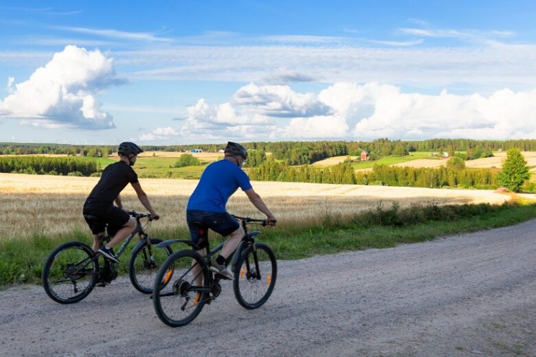
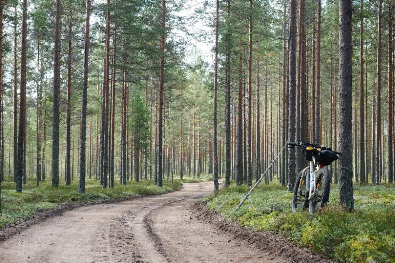
The open pine forests of Pohjankangas rustle past me as I pedal my bike along the smooth and hard-surfaced dirt road. The road meanders gently, sometimes I go around puddles dried up by the summer. The forest landscape changes as the journey progresses, sometimes the road is bordered by young forest, sometimes an open swamp peeks out from behind the pine forest.
When pedaling on Kyrönkankaantie, the mind goes back to the past. The road is part of Finland’s medieval road network, a highway from Finland to Ostrobothnia and an old postal road. It was already known as an old country road in the 15th century – it may have been traveled already before the Middle Ages. It has been easy to travel on foot, horse and cart through the gentle ridges, heathlands and forests. The road traversed uninhabited land, where there were only a few isolated human settlements.

Kyrönkankaantie starts in Hämeenkyrö and continues to Kauhajoki. Today, the road cannot be travelled in its entirety, as part of it passes through a restricted military area of Pohjankangas. However, the section from Kantti village in Karvia to Nummijärvi village in Kauhajoki has mostly been well preserved and and offers a peek to how a roads in Finland used look like in the past.
The best parts of Kyrönkankaantie are the sections in Kauhaneva–Pohjankangas National Park. When pedaling in the sandy ridges of Pohjankangas, you can see gentle dunes peeking out of the pine forest, which tell you that the area has once been more open than it is today, during the seaside phase after the ice age. Of course, there are also sand pits and signs of forestry along the way, providing some open landscapes.
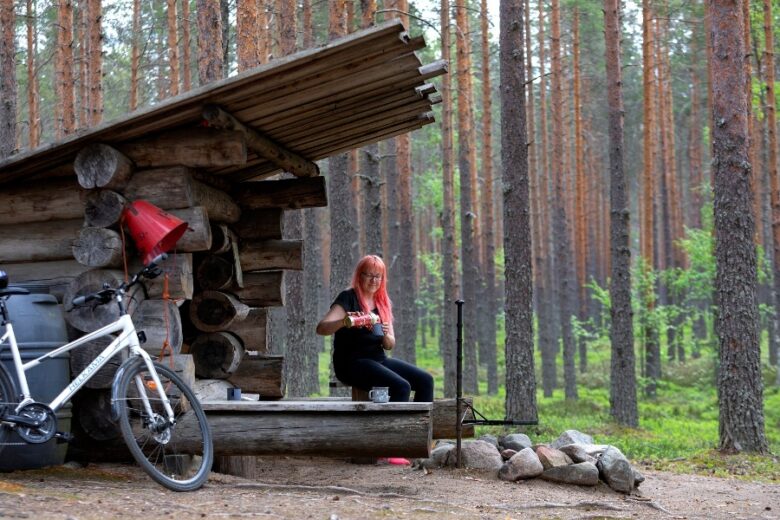
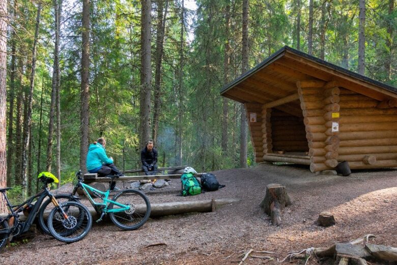
In Salomaa, I stop at the southern campsite of the Kauhaneva–Pohjankangas National Park. The campsite is equipped with a lean-to shelter and is located on the edge of the forest and the mire. I pump some water from the well at the campfire site and take a short break. I have spent some nights here in the past, but now I’m only taking a short break.
Cycling into the heart of the mire
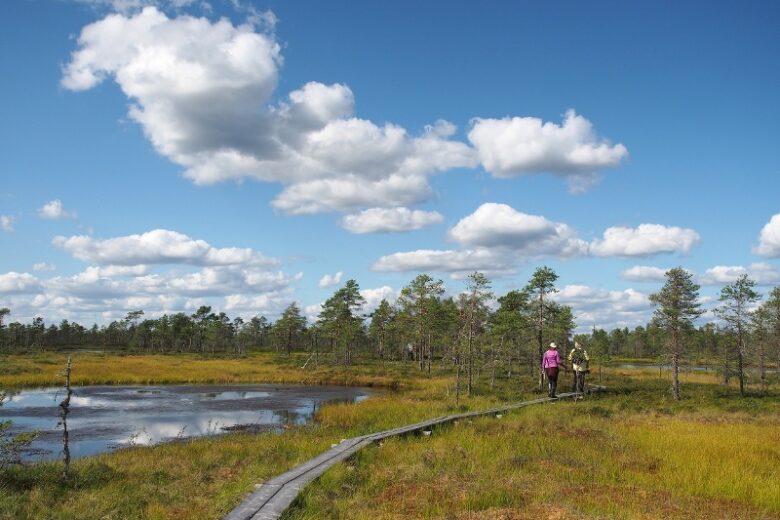
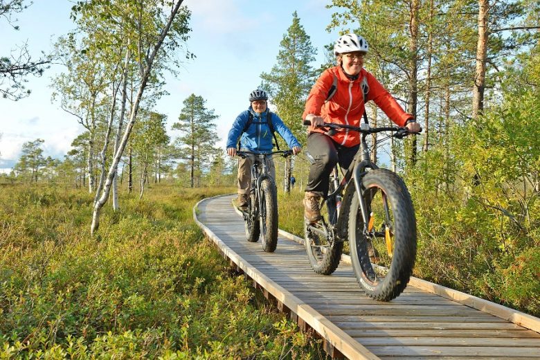
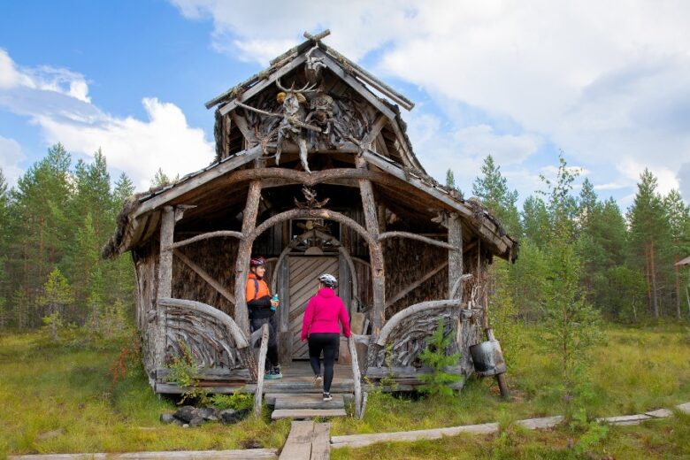
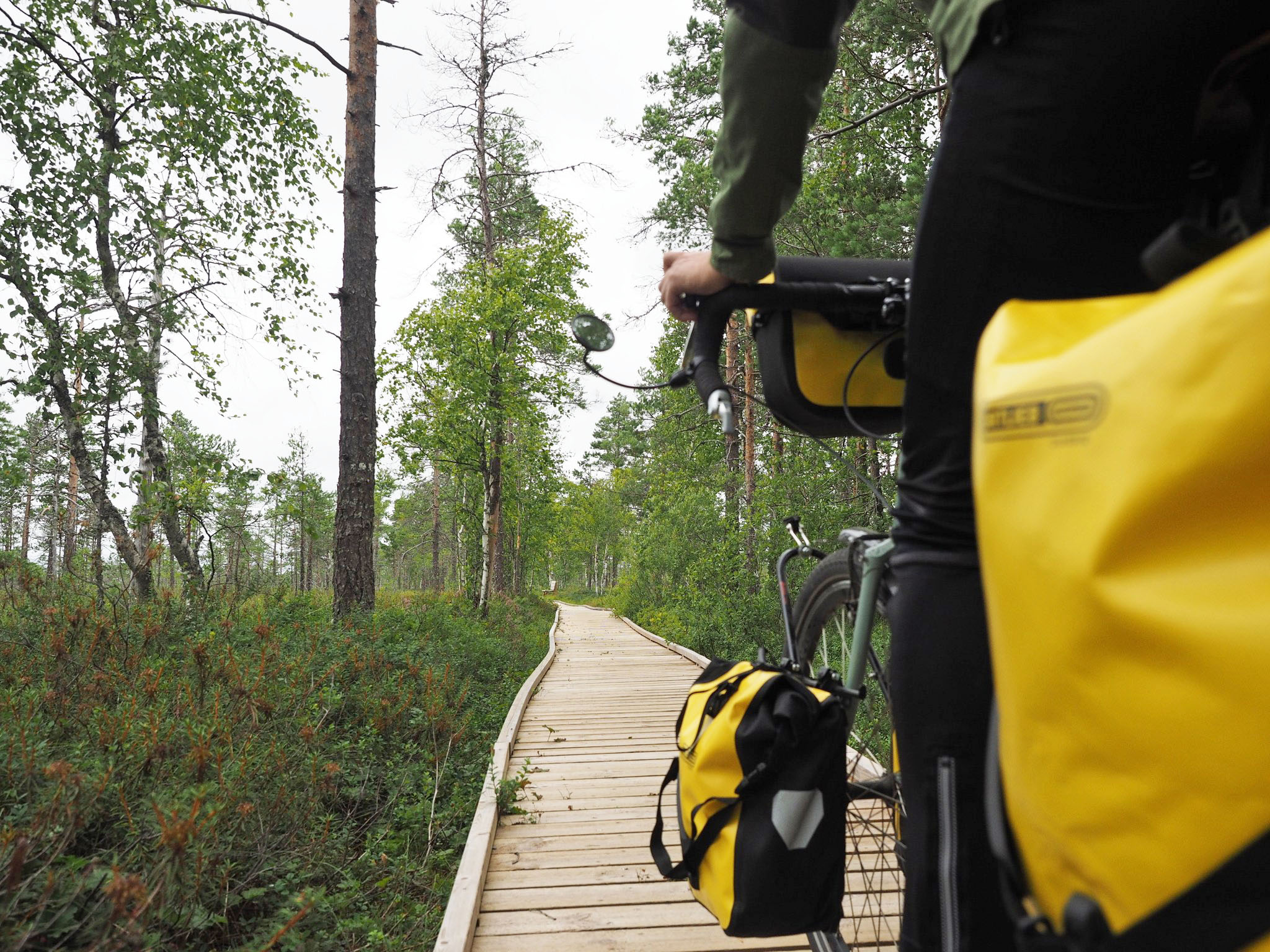
The crossing of Kauhaneva mire is the most exotic of the sections of Kyrönkankaantie. Although the road is largely passable by motor vehicle, the section crossing the Kauhaneva is reserved only for walking and cycling. To the north of the Salomaa Parking Area, the road narrows and old rounded stones stand out from the surface of the road. At the edge of the swamp, the route turns into a barrier-free plank path. This section once had wooden bridges, and sand and gravel surface. Sand and gravel had been taken from ridges at the edge of the mire. The landscape is dominated by a barren and open raised bog with gnarly looking pines.
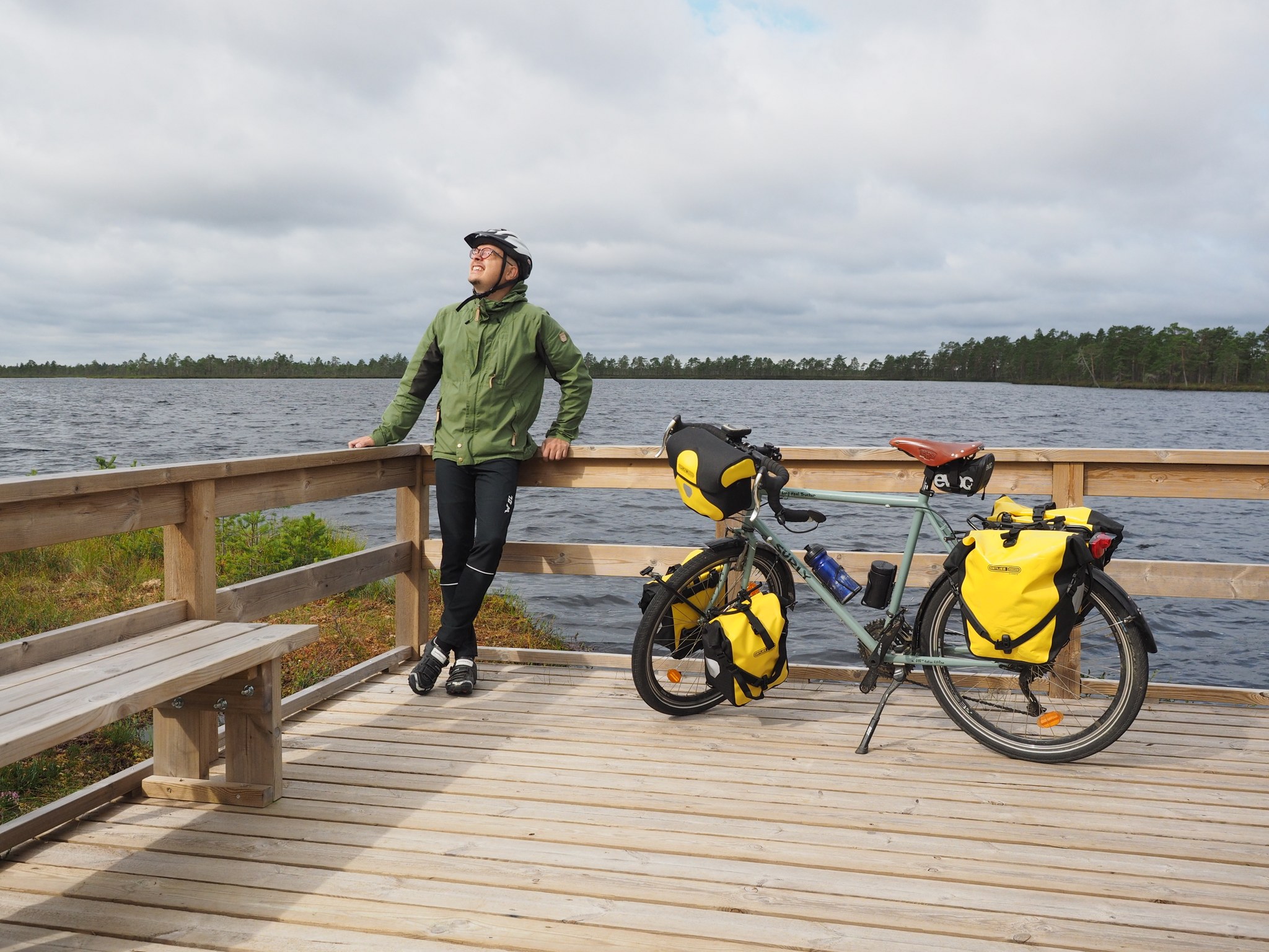
On the shore of Kauhalami, I stop by the viewing platform built on the shore of the pond to admire the view. The pond is actually a small lake, there is a duckboard trail around it. However, the duckboard trail Kauhalammi is intended for walkers, not cyclists. After Kauhalammi, the route runs along a low, sparsely forested ridge of dry land, which eventually spreads out into the broad Nummikangas esker. On the north side of the mire , there is a campfire place and a viewing tower, from which you can view Kauhaneva’s hummocks and hollows from above. In good weather, on the horizon to the west, you can also see the highest hill in the area in the neighboring Lauhanvuori national park.
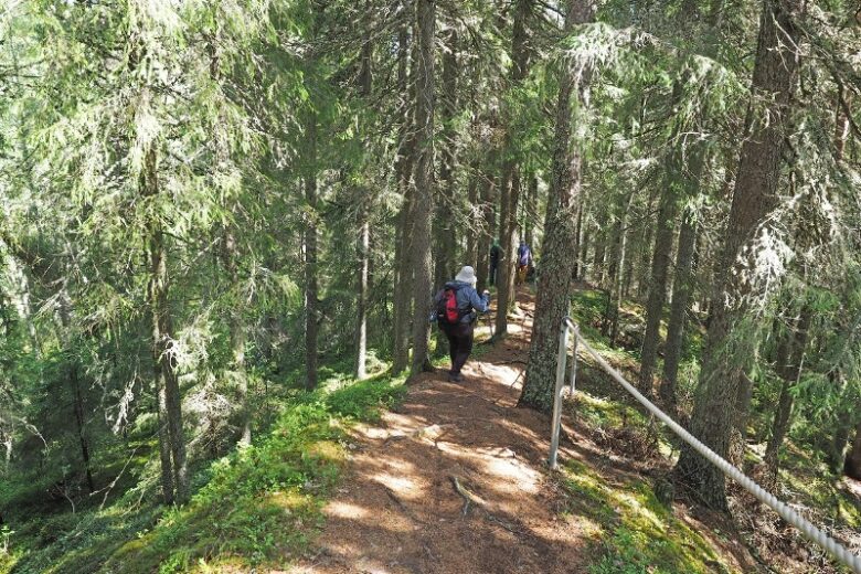
On the esker again
The road continues with a sandy surface on Numikangas esker. At the Kuivakaivo kettle hole, there is a small guide board on the side of the road. I aim at it with my phone to see the content on it. The QR code opens a page that tells about Kuivakaivo’s kettle hole mire. There are not too many kettle holes in Pohjankangas, but for some reason there are several Nummikangas. The road continues slowly towards Nummijärvi, where it joins the tarmac of Karviantie road at Lapinkaivo.
At Lapinkaivo, I stop by to explore the kettle hole pond with its old stories. There is also a memorial of the famine years. A lot of history has been spread along the old road. In Nummijärvi, a memorial of the War of Finland (1808 – 1809) and a fascinating village road awaits me, in a landscape which could just as well be from Lapland or North Karelia. The water surface of Lake Nummijärvi in the background ripples at a height of about 160 meters above sea level – a dozen meters higher than the water level of Lake Kemijärvi. Lakes at the same heights can be found in Eastern Finland. Of course also from South Ostrobothnia, from Ähtäri and Soini. It’s no wonder that there is a harsh northern spirit in nature.
I end the Kyrönkankaantie tour at the Nummijärvi campsite. In the sauna, I wonder if I will go back the same route, if I will perhaps continue along the National Parks route to Lauhanvuori or along the Arts route via Karvia back to Kantti. Lots of good options.
Text: Pasi Talvitie
Trails and routes in Kauhaneva and its surroundings