“Making Geoscience Visible” Project
Geological inventories in the Lauhanvuori–Hämeenkangas Geopark area were supplemented in 2024–2025 through the Making Geoscience Visible project, funded by the EU Rural Development Programme. The inventories now cover the entire Geopark area, including the extension areas for which no previous surveys existed.
During the project, an extensive body of literature and spatial data was compiled, and a total of 43 new geological sites or nature reserves were surveyed. In addition, information on 44 previously known sites and on existing Geopark geosites was compiled into the project report. Altogether, the report describes 155 sites.
The inventories revealed geological formations and phenomena in the area that had not been documented before. Most of these relate to the development of the region’s soils and to glacial-stage processes. New observations were also made of the bedrock, and geological themes not previously presented at existing Geopark sites were identified. Extensive aerial photography with a drone was also carried out at many Geopark locations.
Mires
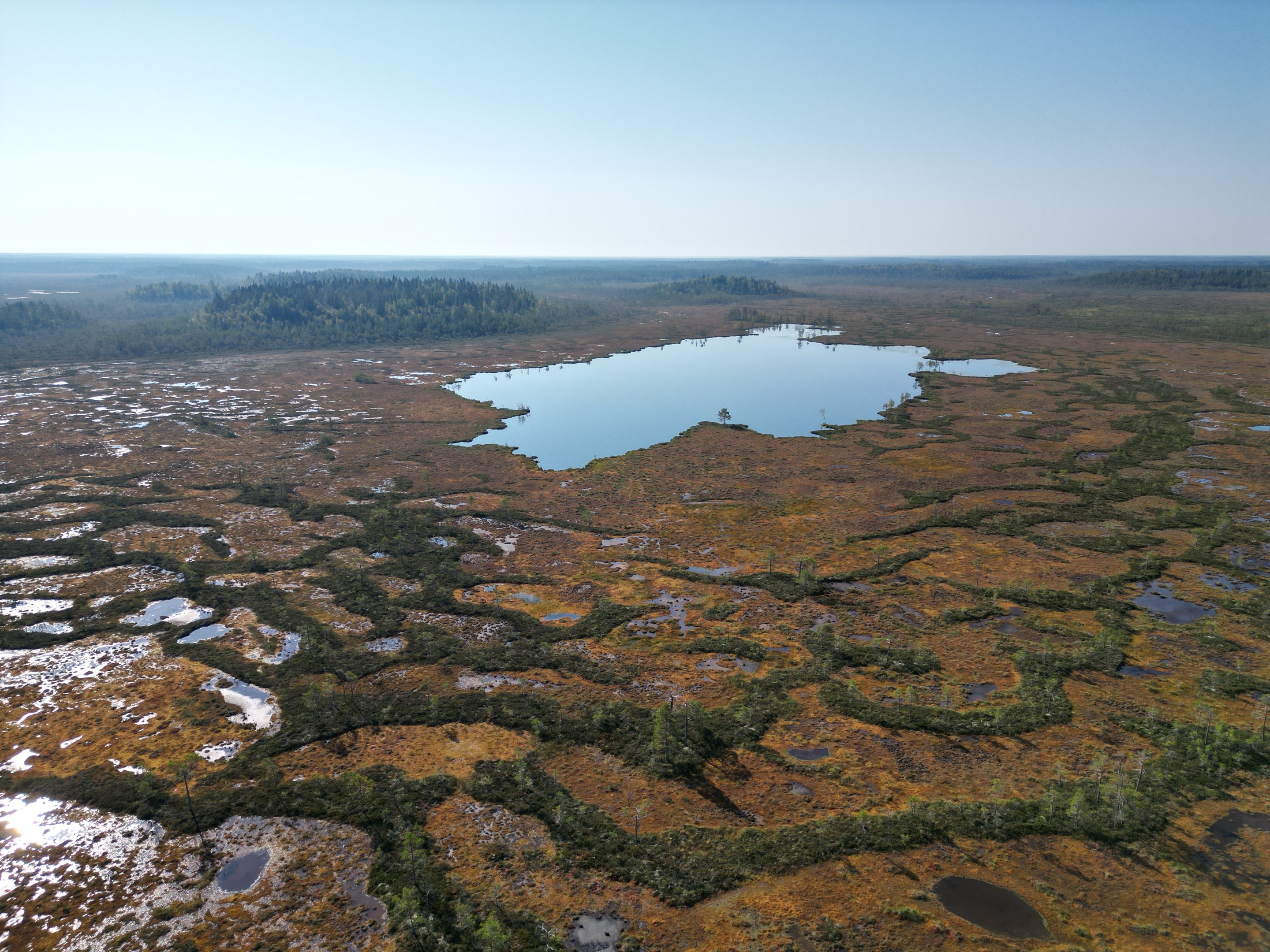
The youngest Quaternary deposits in the area are the mires, which are approximately 5,000–9,000 years old. More detailed peatland surveys were conducted both at Alkkianvuori and Neva-Lyly.
At Raatosulkonneva on Alkkianvuori, the structure and development history of the peatland were examined. It is a slope mire where the peat layer is very thin in the lower parts—only about 20 cm in places. Beneath the peat lies water-saturated sandy till, which provides clues to the mire’s formation. Raatosulkonneva originated through the paludification of forested land, a process strongly influenced by the area’s high precipitation.
At Neva-Lyly, the understanding of the peatlands surrounding the lake was refined. These peatlands are also relatively thin. The substrate consists of sand, till, and bedrock. Neva-Lyly forms part of a wider network of peatlands through which waters originating from Alkkia’s Tunkiosalonneva flow toward Lake Kuivasjärvi in Parkano.
A peatland survey was also conducted—based on archival material—for Peuraneva in Karijoki, where a planned trail is intended to circle Lake Peurajärvi.
Superficial deposits
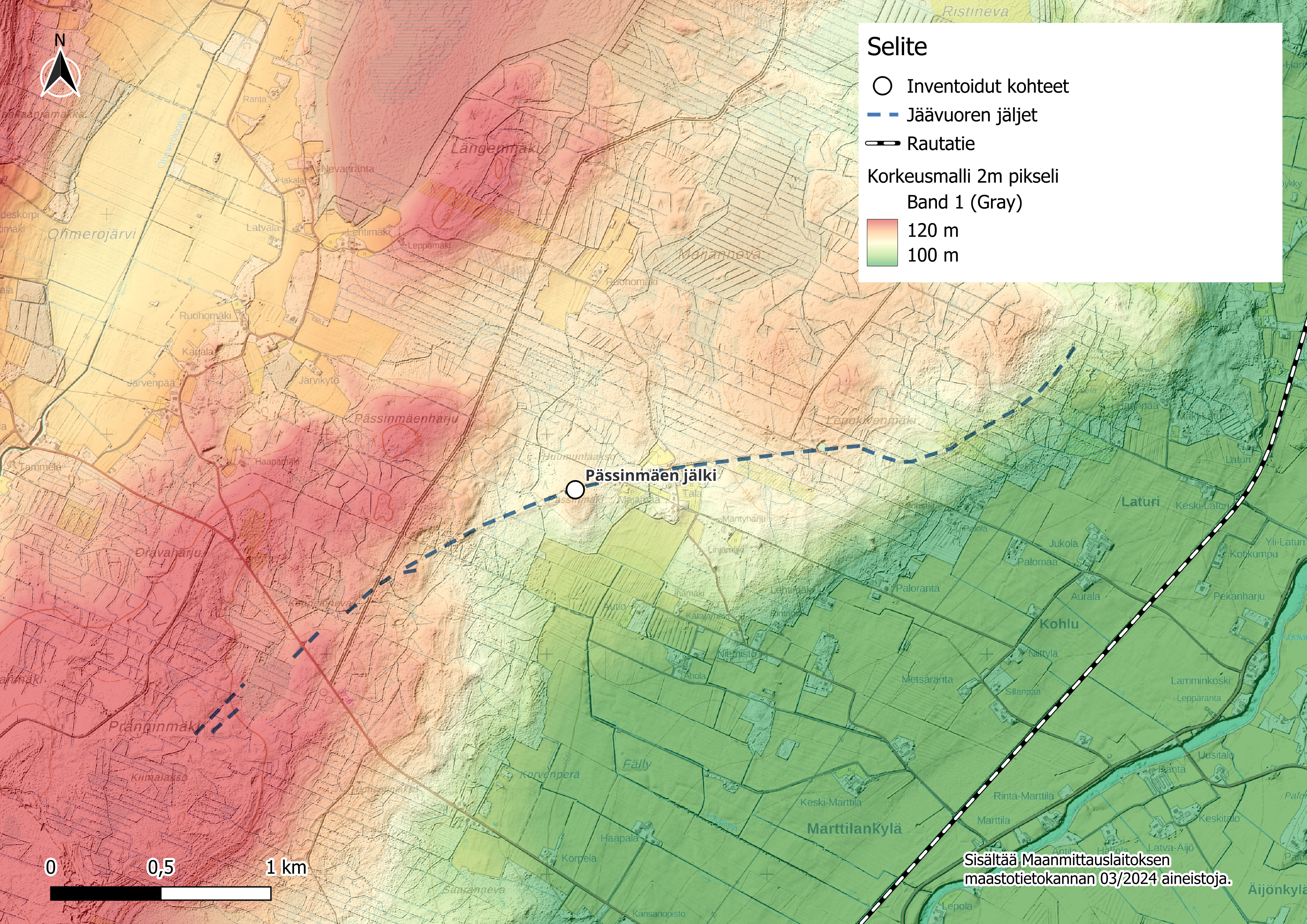
A notable discovery from the late glacial period is the abundance of iceberg keel marks, of which dozens were identified. These features were formed during the postglacial Ancylus Lake stage, when large icebergs calved from the retreating margin of the continental ice sheet. As the icebergs drifted slowly with the water currents, their deep-reaching keels ploughed the lakebed, carving grooves approximately 20 metres wide, 1–2 metres deep, and ranging from a few dozen metres to nearly three kilometres in length.
The longest iceberg keel mark in the area is located at Pässinmäki in Kauhajoki, while the highest concentrations occur in Siikainen, Isojoki, and Karijoki. Iceberg keel marks are known elsewhere in Finland as well, but no comprehensive nationwide documentation yet exists. Similar features have also been described in the present-day Baltic Sea, including along the Baltic coastline.
Another distinctive Quaternary feature of the region is the presence of till-covered glaciofluvial landforms.
These formations are already known in the area, but lidar data suggests that they may be more numerous than previously documented. Many of them also continue beyond the borders of the geopark area. Their main distribution lies north of the Kankaanpää–Siikainen line, west of Pohjankangas, although field observations show that some occur east of Pohjankangas as well.
Till-covered glaciofluvial landforms—also known as buried eskers—formed before the final stage of ice retreat during the last Weichselian glaciation. Some may originate from earlier melt phases within the Weichselian, while others may date back to the preceding Saale glaciation. The till cover was deposited when the continental ice sheet, after a phase of retreat, advanced again over areas that had already been deglaciated, burying previously formed eskers and delta deposits beneath a new layer of till.
These buried eskers are important for groundwater dynamics. They do not necessarily recharge groundwater locally; instead, the water may originate from more distant areas—for example, an esker beneath a river valley may receive groundwater from surrounding uplands. Buried eskers located beneath layers of till and clay may also contain pressurised groundwater, which is an important factor to consider in land-use planning and construction.
Bedrock
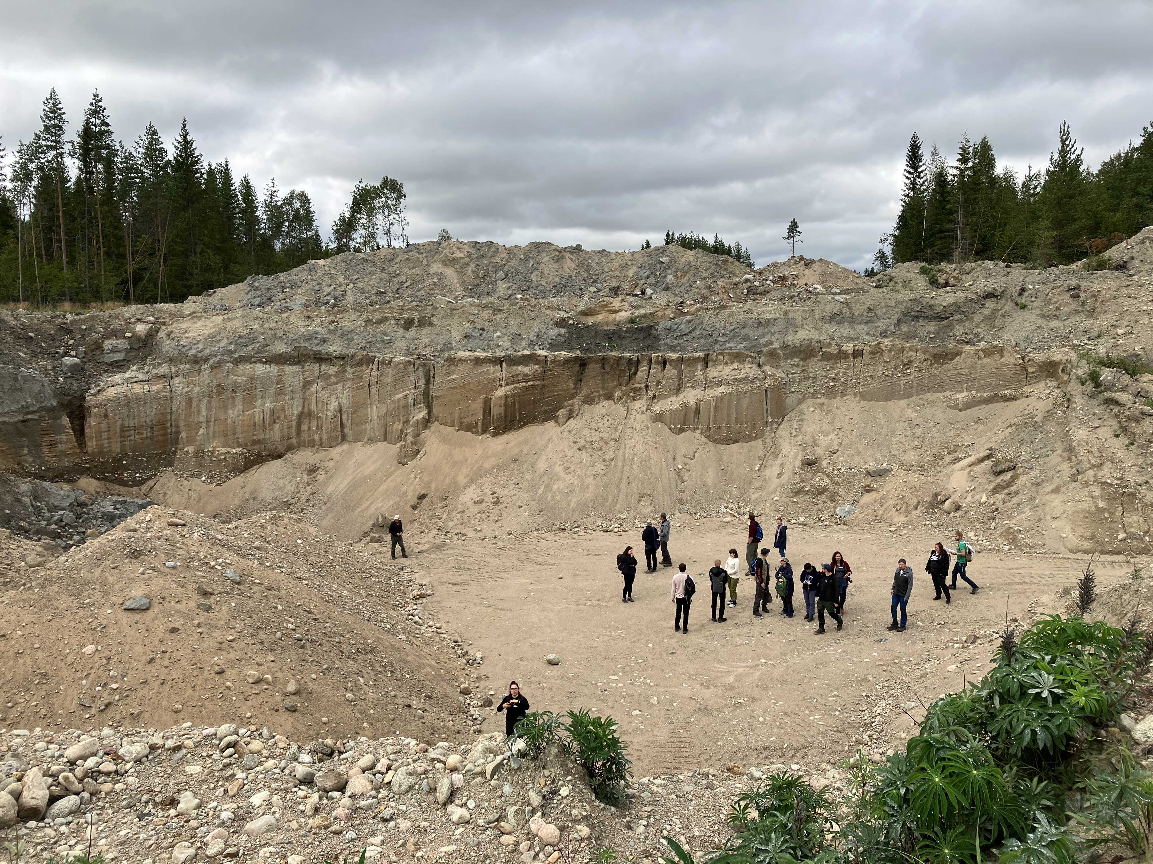
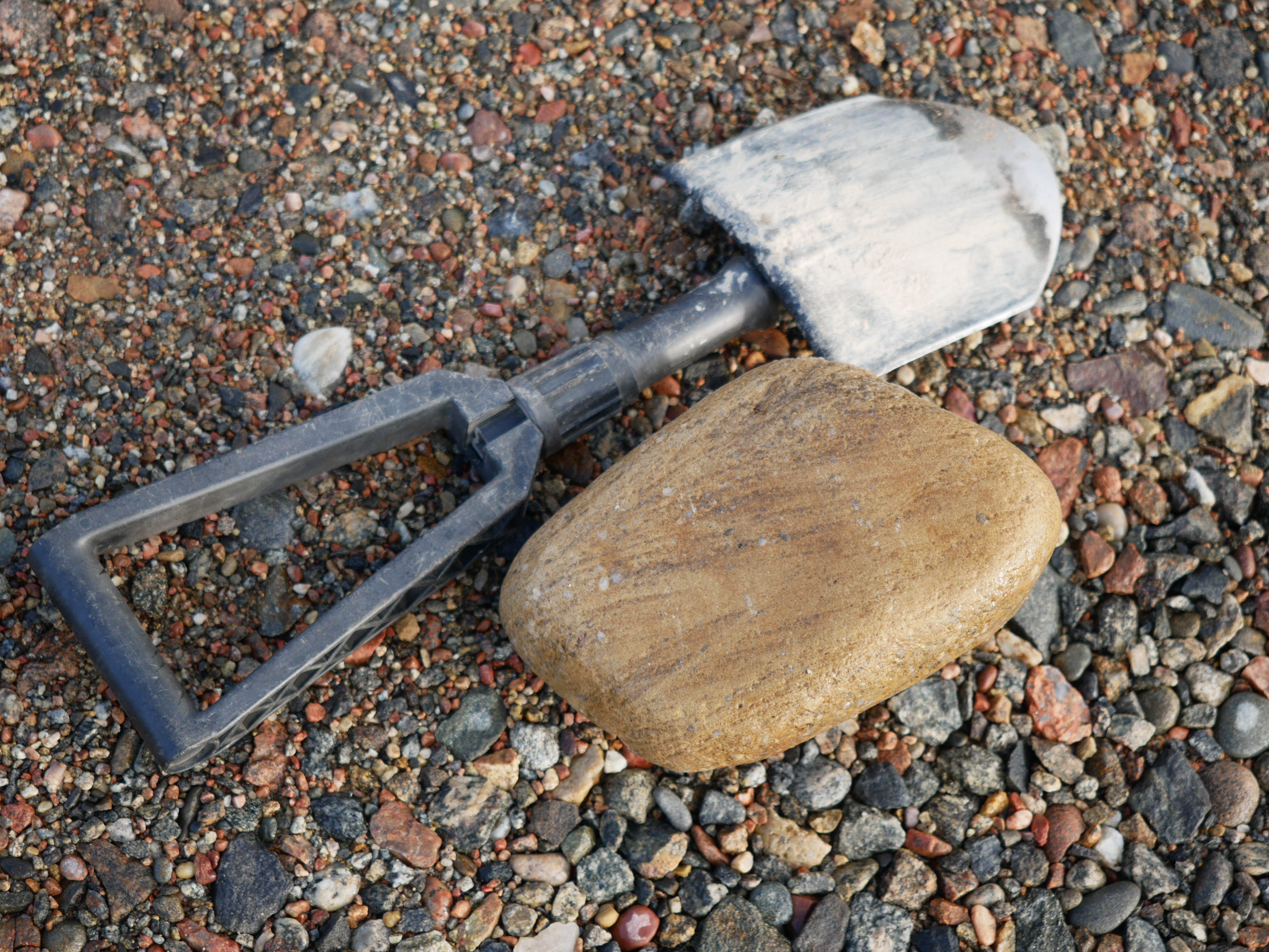
In addition to the Quaternary deposits, new observations were made regarding the region’s bedrock. A distinctive feature of the area is the presence of sedimentary rocks, the most famous being the Lauhanvuori sandstone. At the surface, sandstone is visible mainly in the stone fields of Lauhanvuori, but occurrences are known elsewhere as well. For example, studies have revealed sandstone beneath the thick overburden of Karhukangas.
A new sandstone occurrence was identified approximately 25 km northeast of Lauhanvuori. The rounded sandstone clasts found within an esker cannot originate from Lauhanvuori, meaning their source must lie further north—possibly in the Ikkeläjoki valley. However, the subsurface beneath the thick sediments of the river valleys is still poorly understood.
Trace fossil finds have also been documented in sandstone around Lauhanvuori. There are plans to apply for funding to study this topic further in collaboration with the Geological Survey of Finland (GTK).
A previously unreported observation concerns a quartz vein cutting through sandstone. No such cross-cutting structures have been described from the area before. The feasibility of determining the age of the quartz vein is currently being examined.
The area also features numerous tors and other bedrock weathering formations. Traditionally, they are known especially from the surroundings of Lauhanvuori and Ikkeläjärvi, but tor-like rock hills are also found in Siikainen, Kankaanpää, Karvia, and Kristiinankaupunki, and possibly elsewhere in the region.
Tors are rounded blocks of rock, remnants of ancient weathering that occurred in a warm climate. The surrounding bedrock has weathered and eroded away, leaving the tors standing in the landscape. They are typically found on rounded rock hills or occurring as clusters of large, rounded boulders. The soil around tors often consists of loose grus-like weathered bedrock debris.

The area also contains numerous volcanic rocks. Most volcanic rock outcrops are located in remote areas and lie beneath thick layers of soil, but in and around the Kankaanpää town centre there are also extensive volcanic rock formations. For example, Kelminmäki, rising on the shore of Lake Ruokojärvi, features prominent volcanic rock outcrops.

Bedrock Raw Materials
The Geopark area has also hosted mining activities. The Otamo Mine in Siikainen is the largest former mine in the region, where dolomitic limestone was extracted. Limestone was also quarried on a smaller scale at Somerokallio in Isojoki, and gemstones have been quarried at Venesjärvi in Kankaanpää.
In addition to mining, stone has been quarried for building purposes. The granite quarries of Iso Kakkori are located in one of the area’s most scenic viewpoints.
New Materials
The project has produced a geological hiking guide and a geological hiking map for the Geopark area. In addition, a comprehensive inventory report with appendices has been compiled based on the geological survey data. Separate reports have also been produced on the fieldwork carried out by GTK. The project has furthermore created video materials, including three geological hiking videos and several short aerial videos compiled from drone footage taken during the inventories.
Links to materials:
Hiking guide and map
Geological hiking guide, EN
Geological Hiking map FI+EN
Inventory reports and their appendices (in Finnish, one in Swedish)
Geopark-alueen inventointiraportti
Geologisen inventointiraportin liitteet 1-3
Geopark-alueen kirjallisuusluettelo
Pyhävuoren alueen geologinen inventointiraportti
Geologisk inventering av området Bötombergen -rapport
Suoinventoinnit GTK
Geofysiikan tutkimukset GTK
Videos:
Geological hiking videos produced in the project. Production: Parrikaadi Oy.
Mires:
Soil:
Bedrock:
Drone videos:
Drone videos compiled from the material filmed during the project’s geological inventories.
Filming: Pasi Talvitie, Editing: Rock My Business Oy.
Kauhaneva:
Lauhanvuori:
Mustansaarenkeidas and Haapakeidas:
Neva-Lyly and Alkkianvuori:
Peurajärvi, Iso Kakkori and Susivuori:
A compilation video of the above:

