Pirunkierros
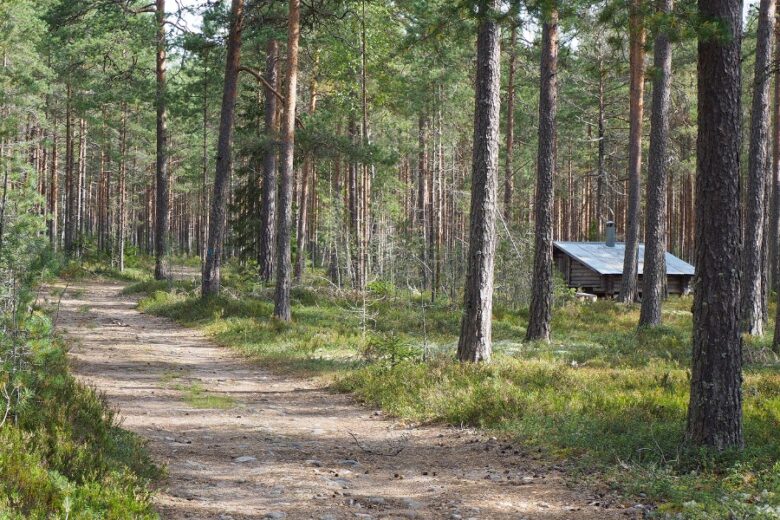
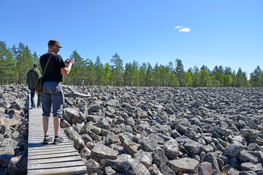
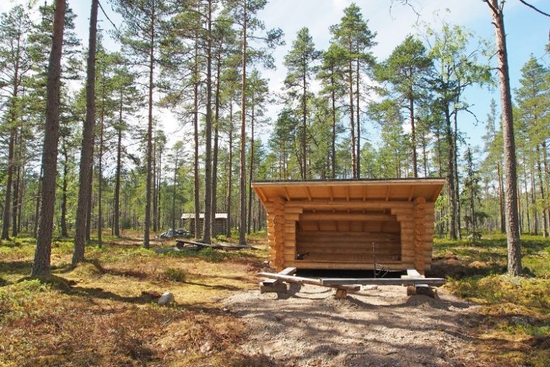
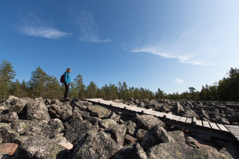
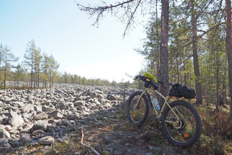
The lower circular route of Lauhanvuori National Park offers an insight into the area's geology. The rock fields, made of rare sandstone, are a special feature of Lauhanvuori. On Kivijata, you can also see the trace of a post-glacial earthquake that splits the rock field. The open pine forests tell of the harsh soil washed by an ancient ice lake, and in the bogs, you can learn about the area's unique groundwater conditions. The route also passes seasonal wetlands. The Leikkistenkangas lean-to shelter provides a peaceful resting spot with wide views of the nearby nature.
The route is part of the main trails of the Lauhanvuori-Hämeenkangas UNESCO Global Geopark.


More about the route
Plan your trip
Start from the parking area towards the south. After about 150 meters, you will reach an information board, in front of which the path continues to the left onto the main Kivijata. A plank path has been built over the part crossing Kivijata. After exploring the unique features of Kivijata, continue east along the path. After about 1.3 km, the path forks; take the right path heading south. After about 1 km, you will reach the edge of a bog. Cross the bog using the boardwalk. After the bog, the path turns northwest. After about 500 meters, you will reach the Leikkistenkangas lean-to shelter. From the shelter, the route continues west, and about 500 meters further is a path junction. Continue straight north; you will see the embankment formed by Kivijata rising behind the forest in the east. After about 500 meters, you will return to the information board mentioned at the start. From the board, continue about 150 meters north to reach the parking area.
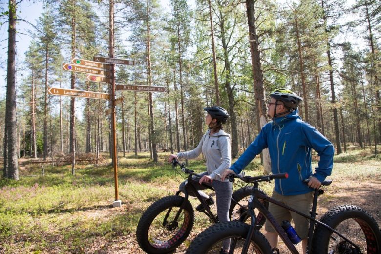
The path is marked at the junctions with signposts reading "Pirunkierros."
No public transport.
By roadFrom the east side of the national park, along road number 44 Kankaanpää-Kauhajoki, there are signs to Lauhanvuori National Park in the village of Muurahainen. Follow them for about 5 km until you reach the gently sloping summit of Lauhanvuori. Continue for another 5 km until there is a road sign to Kivijata on the left. Turn left and continue about 200 meters to reach the parking area.
If arriving from the west, follow road number 664 Lappvärk-Honkajoki. After passing the center of Isojoki, about 1.5 km southeast of the church, there is a junction with signs for Lauhanvuori National Park. Follow the signs and continue about 8 km, until you see a road sign to Kivijata on the right. Turn right and proceed about 200 meters to reach the parking area.
ParkingFree
Similar routes nearby